How a spontaneous winter hike up the Cheviot turned into one of my most challenging – yet invigorating – walks to date.
Distance: 8.1 miles
Time: Approx 6–7 hours
Difficulty: Challenging
Terrain: Steep and can be boggy
Ascent: 638 m (2,092 ft)
Descent: 638 m (2,092 ft)
County: Northumberland
Start: Langleeford (grass verge parking just before Langleeford Farm)
End: Langleeford (grass verge parking just before Langleeford Farm)
On a quiet week in February and a rather uneventful start to 2023, my sister called me on my lunch break. She’d booked a spontaneous weekend break in Wooler, near the Cheviot Hills for her boyfriend, but he declined the invitation. So, she scrambled through her phone contacts to find a last-minute companion. As a lover of walks in the countryside (and being her twin sister), I was the first on her list. Of course I said yes!
Both me and my sister went into this walk complacent. We’d walked the Worcestershire Beacon in the Malvern Hills many times as kids and thought this would be similar, owing to the ‘hill’ category. However, we were wrong, and remarkably I still consider my hike up The Cheviot to be one of my most challenging.
The highest peak in Northumberland, The Cheviot is an extinct volcano 815 metres above sea level – not too shy of mountain status. Part of the Cheviot Hills, it straddles the border between Scotland and England and is often referred to as a mountain range, perhaps a more appropriate description.
Let’s hike the Cheviot
For every walk, I share my favourite photos and memories while leaving some of the views for you to discover.
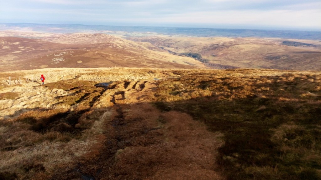
Gorgeous views of the Cheviot Hills in the winter sun (and my sister in her bright red coat).
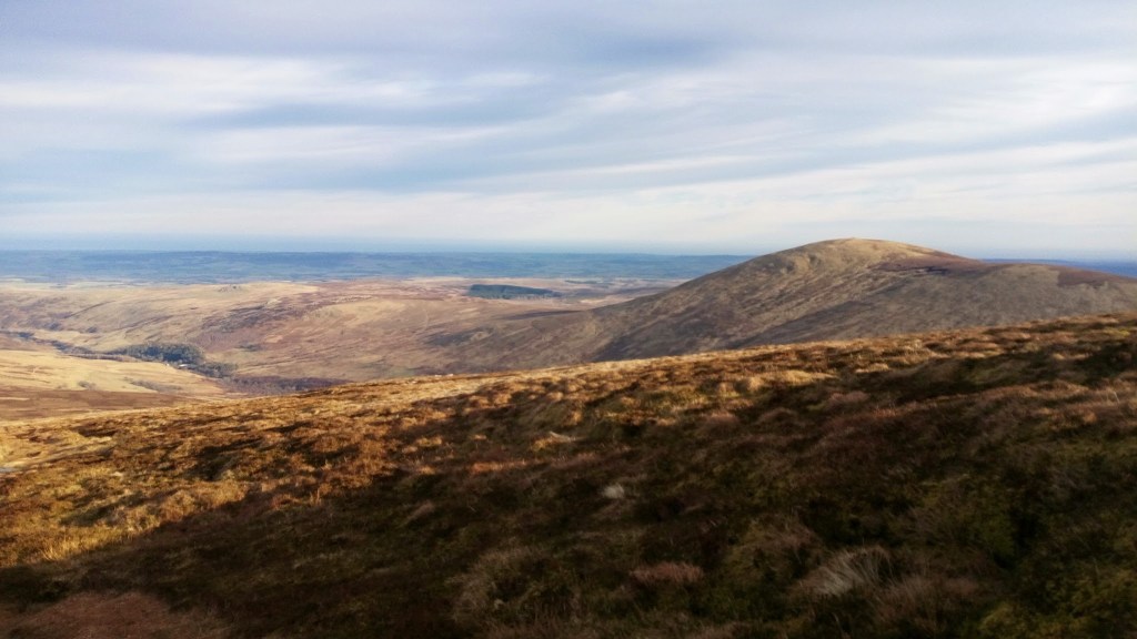
Descending from the summit, with stunning views.
> Begin in the remote valley near Langleeford at the grass verge car park just before a white railed bridge.
> Head a short distance down the road from the car park. Follow the waymarker for Scald Hill to the right.
We asked a fellow hiker for directions and he confirmed that we had walked past the entry point to the hill. Oddly, the tallest peak in the Cheviot Hills didn’t look like the highest hill from the ground! If you’ve walked past Langleeford Farm, you’ve gone too far.
> Continue up Scald Hill. Eventually, after traversing grass, bog and steep, slightly rocky inclines, you will reach a stile. Head over the stile and find the Cheviot Trig Point along a paved walkway. You’re at the highest point in Northumberland!
> Return back the way you came. The best views are on the descent, so make sure to soak in the beautiful scenery. If you’re lucky, you may even see the sea on a clear day.
Time estimate:
This very much depends on your ability to traverse challenging terrain. Often it takes longer to climb up the hill than to come back down. From the car park to the peak, we took around three hours.
Difficulty level:
This hike is challenging! The path isn’t necessarily obvious, in winter it’s extremely boggy and it gets very steep near the top. It’s also not clear that you’re about to reach the summit, making this a psychologically challenging hike too.
Amenities & places to eat:
There are no toilets or places to eat on this route. If you’re staying in the nearby town of Wooler, we can recommend the local pubs for dinner.
Places to stay:
If you’re looking for accommodation, I recommend staying in the town of Wooler. We stayed for one night at the No.1 Hotel on the main street of the town, which offered a cosy stay with friendly staff and 17th century-inspired decor.
Places to park:
There is a place to park at the foot of the Cheviot Hill in Langleeford. To access this you need to be a confident driver as it involves driving up (and down) some extremely steep roads. The roads are also quite narrow in parts. But don’t let this put you off. Me and my sister chickened out of driving into the Northumberland National Park and it added two hours of walking to our day!
Best time to do this walk:
I completed this walk on a crisp early February day. Conditions at this time of year were extremely boggy and slightly icy at the top.
The beauty of doing this walk in winter is that it’s quiet. Until we neared the summit, we barely saw anyone on the hill, leading us to often wonder if we were heading in the wrong direction.
The downside of doing this walk in the winter was the boggy terrain. This slowed us down considerably. Both me and my sister lost a shoe and had to hop awkwardly around to retrieve them.
We marvelled at the people that ran down the hill as though they were doing their weekly Park Run! We also pitied the woman wearing cream leggings and Converse pumps just beginning her hike as the daylight started to recede! She clearly didn’t know about the bog either.
But, it was all part of the experience. Had we known what we were letting ourselves in for, we probably would have turned back before reaching the halfway point. But then we would have missed out on the pride of reaching the top (and the glorious views of the Cheviot Hills in the winter sun).
Hazarding a guess, spring and autumn are probably the best off-peak times to complete this walk. There are plenty of pictures of people reaching the summit with snow on the ground, so if you have the right gear and hiking experience, this could be a satisfying challenge, especially for the picturesque views.
Staying safe:
This is not an easy climb!
It’s also important to consider the available daylight hours to determine whether it’s possible to complete the climb before sunset.
I would postpone this walk in the event of a heatwave, storms, fog, high winds or icy conditions.
What to wear & pack:
- A fully charged phone
- A waterproof coat
- Hiking boots (Comfortable, watertight shoes that you don’t mind getting obscenely muddy are a must.)
- Hiking boot socks
- Trousers or leggings that you don’t mind getting muddy
- Walking sticks (for people with knee aches)
- Plenty of snacks and water
- Hat and gloves
- Blister plasters
Fancy more walks in the area?
The other side of the Cheviot, just shy of the Scottish border, offers some popular scenic points, including the Hen Hole and Davidson’s Linn. For a tranquil walk, you also have the nearby Threestone Burn nature reserve and the Linhope Spout Waterfall in the Breamish Valley.
Quiet Roams rating:
⛰️⛰️⛰️⛰️
4/5. Even with the boggy conditions, and the thought of turning back at one point, this hike still gets a solid four stars from me. It felt like an achievement and the winter sun at the top was beautiful.

Leave a comment